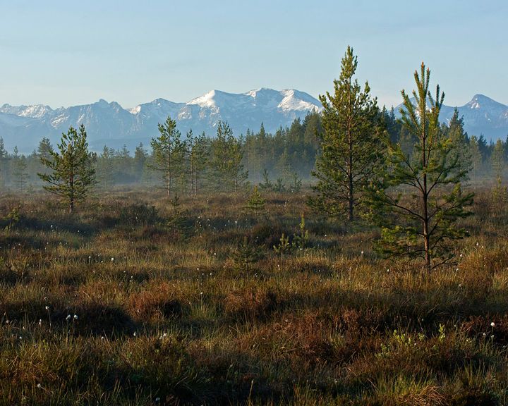
Orava-Nowy Targ bogs - short description
2021
2025
History of the site
This is a raised bog land. The development of individual peat bogs in the area began at different times during the Holocene period. The Baligówka peat bog is considered to be the oldest, estimated to be around 9,000 years old. Until the agricultural colonisation of the area began (the Middle Ages), the entire Orava-Nowy Targ Basin was covered by a peat layer of varying thickness. Agriculture developed in the areas with the thinnest peat layer. At present, remnants of this layer can be found in the form of meadow peats and forest peats (bog forests). Most of the domes of the raised bogs (places with the greatest thickness of peat, not used for agriculture) have survived, but their area has been significantly reduced, mainly as a result of peat extraction (for fuel, horticultural and medicinal purposes) and the burning of peat bogs for arable land. The destruction of the peat domes began in the 19th century, and today its scale is much smaller, but locally peat continues to be extracted - legally by the Peat Factory at Podczerwone (the extraction area covers 13.2 ha) and illegally in various places by local people.
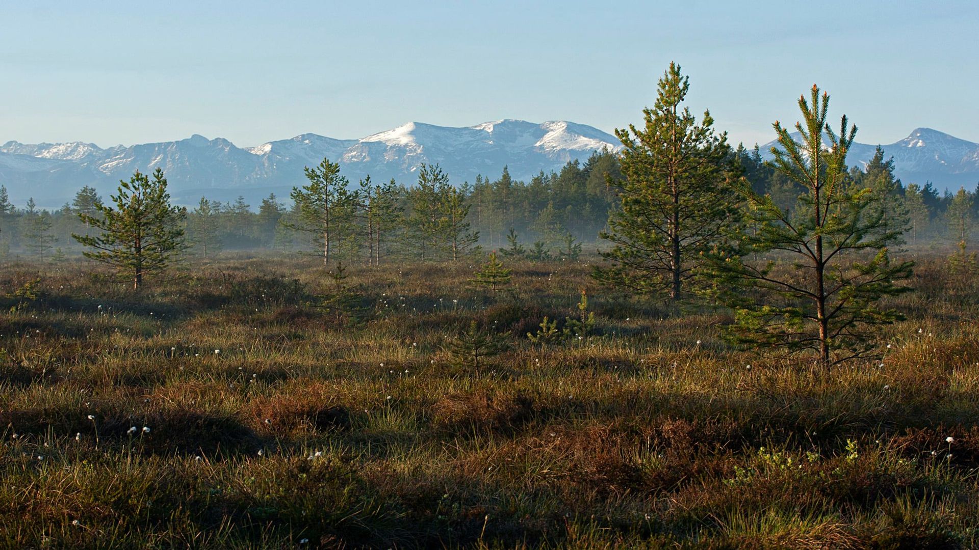
photo by Aleksandra Pępkowska-Król
Connectivity
Orava-Nowy Targ bogs are one of the biggest complexes of raised bogs and bog woodlands in Poland and the biggest one in the Alpine biogeographic region, with adjacent areas of alkaline fens. The unique mosaic of raised bogs (almost 20 domes), bog forests, alkaline fens, riparian vegetation, hay meadows and Nardus grasslands are protected as Natura 2000 site Torfowiska Orawsko-Nowotarskie PLC120003. Grasslands and meadows are partially used for agricultural production. No major built-up areas are located in this area. Ecological connectivity of the peat domes is still well preserved, although it is steadily deteriorating as a result of progressive housing and infrastructure development.
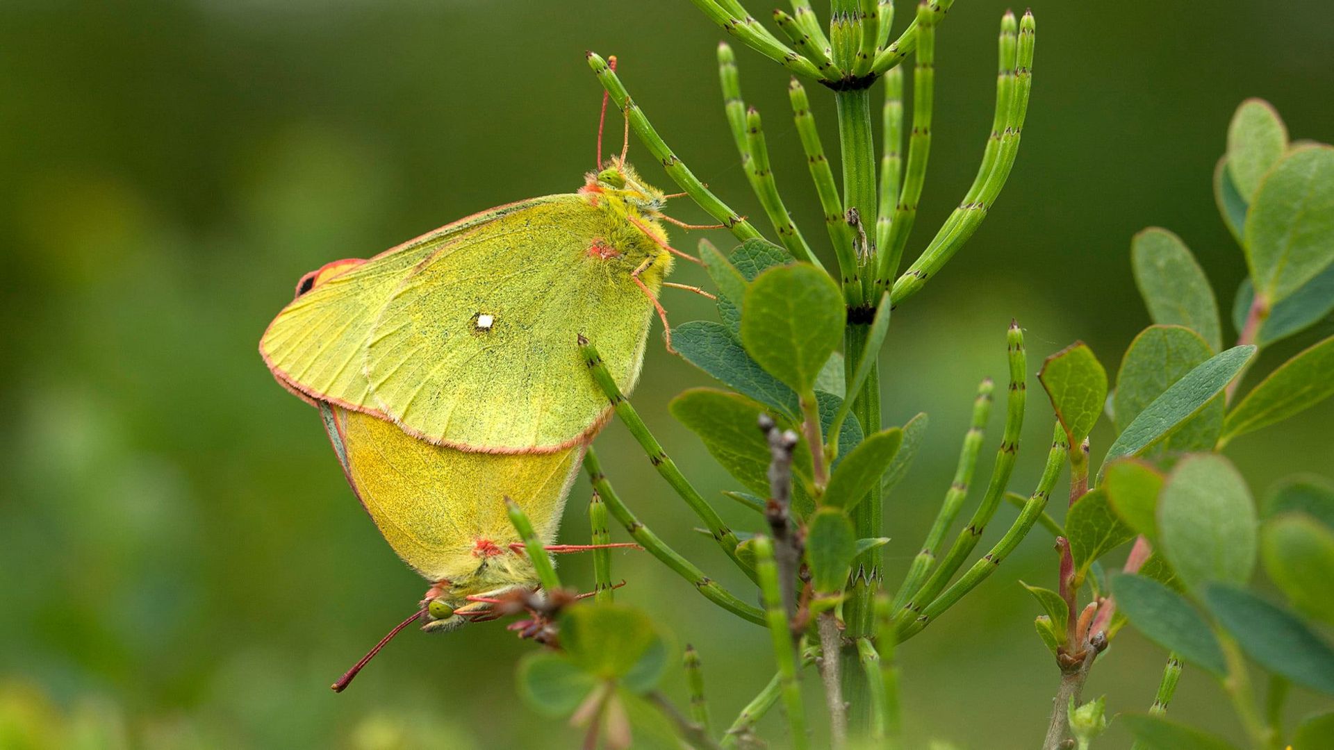
Colias palaeno, photo by Aleksandra Pępkowska-Król
Characteristics of the site
The area is located in the Orava-Nowy Targ Basin, which is a flat, intermountain plain with an open character, cut by river valleys, the largest of which are the Dunajec and Czarna Orawa. The topography of the region is enchanced by domes of raised bogs, highly overgrown and accompanied by spruce and pine forests. As a result of former drainage works, the peat bogs are now cut by ditches and heavily drained, and their edges are elevated above the surrounding terrain as a result of peat extraction. Private ownership predominates, for both peatlands, woodlands and agricultural areas, although the proportion of municipal ownership is significant in places. E.g. three peat bog domes on which conservation measures are being implemented are under municipal ownership.
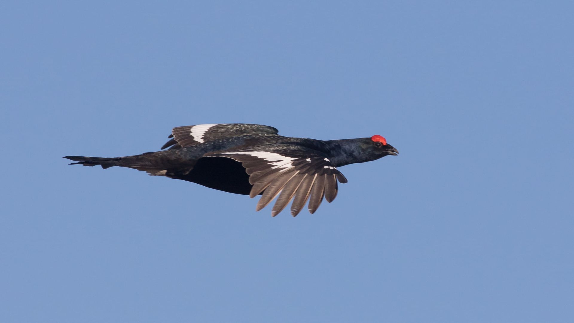
Lyrurus tetrix, photo by Tomasz Wilk
Problem, threats
The peat domes in the area face the threat of active drainage ditches and af-/reforestation, which cause a continued negative impact on the health of the peatland habitats. Degraded peatlands contribute to climate change. The degraded conditions of the project sites lead to continued drying out and this causes an increased rate of peat decay. These processes are exacerbated by the drought. As a result, significant additional GHG are released into the atmosphere and nutrients are released into
downstream waters via receiving waters, causing eutrophication problems. Drainage stops also the peat-forming process and causes peatlands not to grow anymore. The disturbed hydrological system in the area contributes to the degradation of the peatland-dependent habitats (7110, 7120, 91D0 and 7230), as well as endangered species, such as the Black Grouse, whose declining population occupies an area of peatlands.

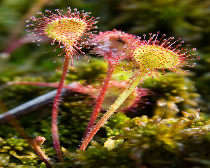
Drosera rotundifolia L., photo by Tomasz Wilk
Species
The Natura 2000 site Torfowiska Orawsko-Nowotarskie PLC120003 protects 14 habitat types from the annex I of the habitats directive, and 26 species of animals from the annex II of the habitsts directive or annex I od the birds directive. The area of peat domes and their immediate surroundings is especially important for the conservation of vegetation related to annex I habitat types: 7110 (active raised bogs), 7120 (Degraded raised bogs still capable of natural regeneration), 91D0 (Bog woodland) and 7230 (Alkaline fens), as well as for the declining population of highly endangered bird species - the Black Grouse.
photo by Aleksandra Pępkowska-Król
Restoration action
In 2021-2026, Polish Society for the Protection of Birds (OTOP) together with Naturalists' Club implemented the LIFE MultiPeat project, to optimize the hydrological system of degraded peatlands and to reduce greenhouse gas emissions and recover the optimal conditions to restart the sequestering functions in Orava-Nowy Targ Peat Bogs. To achieve this, 252 ha of degraded peatlands were restored and hydrologically improved. Main restoration measures aimed at closing of drainage ditches to raise the water table in three peat domes - Baligówka, Bór za Lasem and Las Kaczmarka. Ditches were blocked by building 151 wooden or wooden-peat dams. Additional measures included the removal of woody vegetation (Pinus spp. trees and shrubs) on 5 ha, to support the decrease of transpiration rates and faster rehabilitation of peat-forming vegetation. Much wider area (ca. 110 ha) was a subject of tree removal as part of a project carried out by the Regional Directorate for Environmental Protection in Kraków on the Baligówka peat dome. The restoration activities follow the existing Natura 2000 management plan.
photo by Aleksandra Pępkowska-Król
Monitoring
A habitat monitoring approach was implemented in the LIFE MultiPeat project, including vegetation, hydrology, GHG and UAV surveys of the peat domes. Vegetation monitoring was carried out on vegatation plots, where data for plant percent cover and target habitat indicator species were gathered. Hydrological monitoring included a measure of groundwater levels at 50 automatic water level monitoring points (piezometer with automatic registators - divers), supported by barodivers and field meteo automatic station (temperature & rainfall), to interpret the measurements properly. The climate impact of the restoration actions was measured by quantifying the GHG emissions, calculating the current annual GHG budgets and the potential savings in the future. GHG emissions during the restoration were monitored by manual, closed chamber-based field measurements of CO2, CH4 and N2O. GHG fluxes were estimated using the GEST method. Unmanned aerial vehicles (UAVs) with multispectral cameras were used to provide high quality orthographic imagery for vegetation map and an assessment of the vegetation cover.
photo by Aleksandra Pępkowska-Król
View
Photos
Photos by Aleksandra Pępkowska-Król, Tomasz Wilk
◀
▶
Partners
Nature-based solutions in open wetlands restoration for biodiversity, water quality improvement and climate mitigation // 1.10.2024 – 30.09.2025
OTOP BirdLife Poland

Ukrainian Nature Conservation Group
Snowchange Cooperative